Rhode Island Historical Cemeteries
Home
Members
Events
Minutes
Database
FAQ/Documents
Links
Groups/Associations
Contact
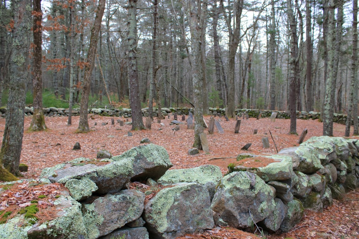
FEATURED CEMETERY PHOTO
Photo/Image Courtesy of Rhode Island Historic Cemetery Volunteers
Cemetery Number
WG054
Town
WEST GREENWICH
Cemetery Name
NILES-NICHOLS-CONGDON LOT
Find A Grave (Opens in New Tab)
Go to Find a Grave
Graves List
Display Graves List
Location
SWEET SAW MILL RD
State
RI
Direction
SE
Pole Number
Distance
600
Map Number
Page Number
Plat Number
Deed Book
Deed Page
Size in Feet
120
Size in Feet
65
Burials
45
Inscriptions
35
Fieldstones
20
Tombs
Exist?
YES
Last seen date?
Newest
1867
Oldest
1763
Vandalism
N
Veteran
0
Pole
N
Comment
0.3 mile from junction with Congdon's Mill Rd. to the opening of a farm field on the right. Follow field 500 feet to SE corner, then go another 75 feet into the woods. Reservoir area. Alternative route: 475 feet north on Sweet Sawmill Road to the first road on the right. 245 feet SE to the first road on the left. Then go 370 feet NE down this road past the pond and over the dam. Go 200 feet SE down the trail to the first trail on the left and 150 feet NE. This cemetery has two crudely carved fieldstones with initials and dates that were later identified as the gravemarkers for Joseph and Samuel Niles using probate records. This helps place the Niles family in this part of West Greenwich. Recorded in the 1970s by Blanche Albro. Recorded in 1992 by John Sterling. GPS coordinates 41 deg. 36' 47.60"N x 71 deg. 36' 56.86W
Condition
fair
Enclosure
stone wall
Gate
no gate
Growth
overgrown-trees
Terrain
level
Cemetery Location
Cemetery Burial Map
N/A
ADDITIONAL CEMETERY PHOTOS/MAPS
 Photo/Image Courtesy of Rhode Island Historic Cemetery Volunteers