| Cemetery Number | SK110 |
| Town | SOUTH KINGSTOWN |
| Cemetery Name | STEPHEN G TEFFT LOT |
| Find A Grave (Opens in New Tab) |
Go to Find a Grave
|
| Graves List | Display Graves List |
| Location | MINISTERIAL RD |
| State | RI |
| Direction | E |
| Pole Number | 5207 |
| Distance | 1050 |
| Map Number | |
| Page Number | |
| Plat Number | |
| Deed Book | |
| Deed Page | |
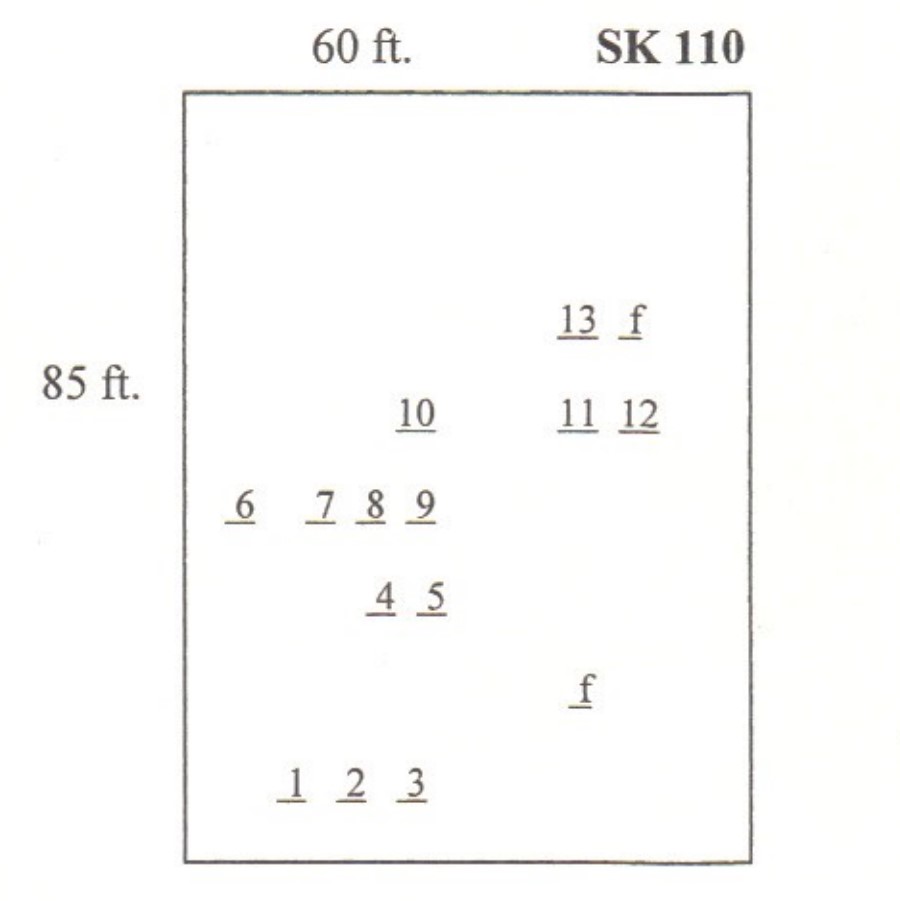
| Size in Feet | 60 |
| Size in Feet | 85 |
| Burials | 19 |
| Inscriptions | 17 |
| Fieldstones | 2 |
| Tombs | |
| Exist? | YES |
| Last seen date? | 2003 |
| Newest | 1920 |
| Oldest | 1859 |
| Vandalism | N |
| Veteran | |
| Pole | N |
| Comment | This cemetery is located 1050 feet east of Ministerial Road at telephone pole #5207, south of Curtis Corner Road opposite the entrance to the Aquapaug Boy Scout camp area. It is 60 feet x 85 feet, in fair condition, enclosed with a stone wall, with an iron gate which is lying on the ground, and no historical cemetery sign. The iron gate to this cemetery was down with a tree, eight inches in diameter, growing through it in 2003. It contains nineteen burials with seventeen inscribed stones and two fieldstones.
James N. Arnold visited this lot Oct. 6, 1880, his #127, “on land of James K. Tefft north east of his house lot fairly fenced.” The next cemetery visited by Arnold, his #128, he described as “on land of James K. Tefft beside wall directly south of the above yard about 25 rods otherwise unprotected all marked with rude stones in one row 25 graves as we counted being the poor of the town who died here while the poor were kept on this farm.” This area was turned into potato fields about sixty years ago [1940c] with stone walls around them. In the 1990s the stone walls were removed, and houses were built on this land according to Woody Tucker.
Found, registered, and recorded by John Sterling & James Wheaton for a 2004 book on South Kingstown cemeteries. |
| Condition | fair |
| Enclosure | stone wall |
| Gate | iron gate |
| Growth | overgrown-weeds |
| Terrain | level |
| Cemetery Location |
|
| Cemetery Burial Map |
|
| |
|