| Cemetery Number | CY182 |
| Town | COVENTRY |
| Cemetery Name | OBADIAH JOHNSON LOT |
| Find A Grave (Opens in New Tab) |
Go to Find a Grave
|
| Graves List | Display Graves List |
| Location | NOOSENECK HILL ROAD |
| State | RI |
| Direction | N |
| Pole Number | 53 |
| Distance | 200 |
| Map Number | |
| Page Number | |
| Plat Number | |
| Deed Book | |
| Deed Page | |
| Size in Feet | 50 |
| Size in Feet | 50 |
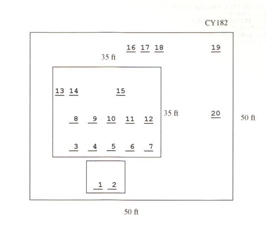
| Burials | 22 |
| Inscriptions | 20 |
| Fieldstones | 0 |
| Tombs | 0 |
| Exist? | YES |
| Last seen date? | 2013 |
| Newest | 1945 |
| Oldest | 1817 |
| Vandalism | Y |
| Veteran | 1 |
| Pole | N |
| Comment | This lot is located 200 feet north of Nooseneck Hill Road at telephone pole #53. This cemetery is 80 feet up the hill from the Johnson-Capwell Lot (Coventry Historical Cemetery #71). The cemetery is 50 ft x 50 ft, in good condition, and enclosed with granite posts and iron rails with an iron gate. There are 22 burials with 20 inscribed stones.
James N. Arnold visited this cemetery on 15 Oct. 1905 and commented, “On the Hill farm the Old Johnson burial yard at Spring Lake, N. W. from the mill, not protected, in open pasture” (Vol. 6, Book J, page 1376). He apparently also visited this lot on 19 Aug. 1893 (Vol. 6, Book 17, page 454) and some burials were moved to Small Maple Root Cemetery (Coventry Historical Cemetery #49) in the interim.
Charles and Martha Benns transcribed this lot in 1934, their #290b.
Amelia K. Whitford also transcribed this cemetery.
Found, registered and recorded by Dr. Bill Eddleman and John Sterling for a 1998 book on Coventry cemeteries. |
| Condition | good |
| Enclosure | granite posts/iron rails |
| Gate | iron gate |
| Growth | cleared |
| Terrain | hilly moderate |
| Cemetery Location |
|
| Cemetery Burial Map |
|
| |
|