| Cemetery Number | CY045 |
| Town | COVENTRY |
| Cemetery Name | MATTESON FAMILY CEMETERY |
| Find A Grave (Opens in New Tab) |
Go to Find a Grave
|
| Graves List | Display Graves List |
| Location | FLAT RIVER ROAD - ROUTE #117 |
| State | RI |
| Direction | S |
| Pole Number | 221 |
| Distance | 1000 |
| Map Number | |
| Page Number | |
| Plat Number | |
| Deed Book | |
| Deed Page | |
| Size in Feet | 50 |
| Size in Feet | 85 |
| Burials | 30 |
| Inscriptions | 27 |
| Fieldstones | |
| Tombs | |
| Exist? | YES |
| Last seen date? | 2013 |
| Newest | 1883 |
| Oldest | 1794 |
| Vandalism | |
| Veteran | 3 |
| Pole | |
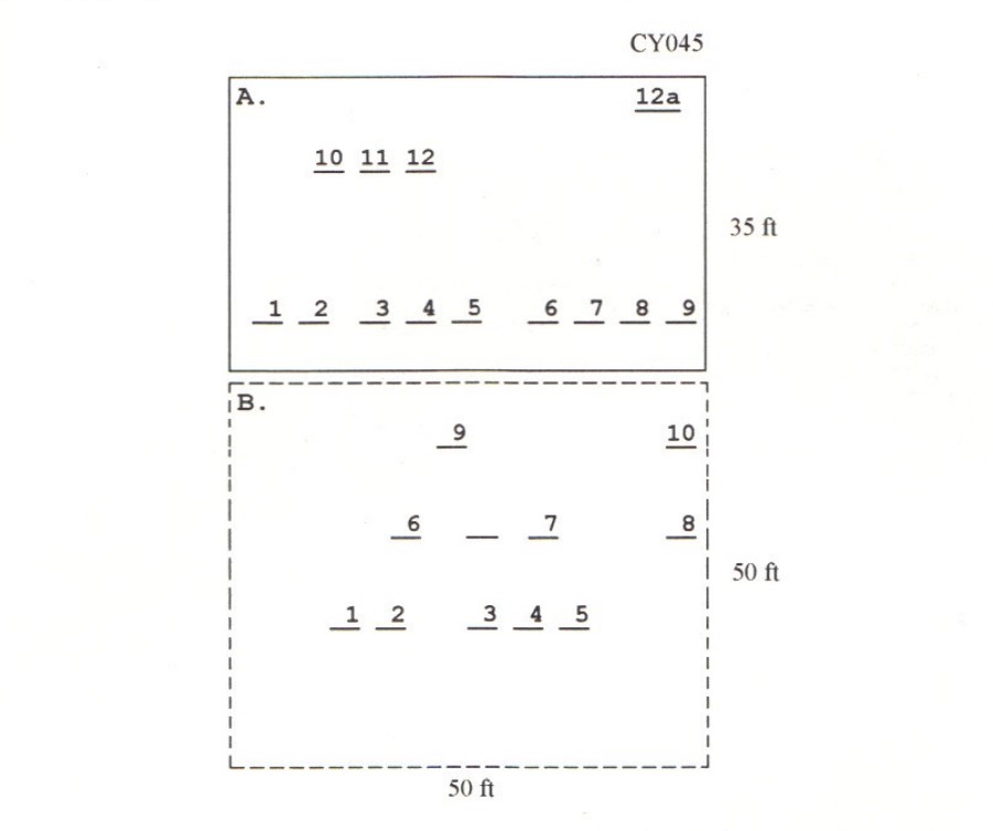
| Comment | This cemetery is located 1000 feet south of Flat River Road (Route #117), at telephone pole # 221, 500 feet behind the dog pound, and across the railroad tracks, soon to be bike path. It is two cemeteries side by side. The eastern one has granite posts around it, is 50 ft x 35 ft, and is designated section ‘A’. The western one has no protection, is 50 ft x 50 ft, and is designated as section ‘B’. There are 30 burials with 22 inscribed stones. One stone is face down in the SE corner, possibly Joab Matteson. The historic cemetery sign is missing.
James N. Arnold visited this lot on 3 November 1904 and noted, “on Matteson Farm on south side of railroad a burial yard of the family, in two lots; one is protected partially yard in good order. The other has granite posts and picket fence, yard in good order” (Vol. 6, page 376).
Charles and Martha Benns transcribed this lot in 1934, their #287.
Recorded by Dr. Bill Eddleman and John Sterling for a 1998 book on Coventry cemeteries |
| Condition | fair |
| Enclosure | granite posts |
| Gate | |
| Growth | |
| Terrain | |
| Cemetery Location |
|
| Cemetery Burial Map |
|
| |
|