| Cemetery Number | CY023 |
| Town | COVENTRY |
| Cemetery Name | NATHAN OLNEY SCOTT LOT |
| Find A Grave (Opens in New Tab) |
Go to Find a Grave
|
| Graves List | Display Graves List |
| Location | FLAT RIVER ROAD |
| State | RI |
| Direction | S |
| Pole Number | 441 |
| Distance | 200 |
| Map Number | 316 |
| Page Number | |
| Plat Number | 87.1 |
| Deed Book | |
| Deed Page | |
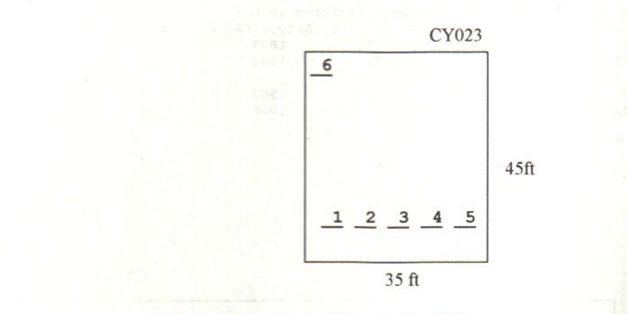
| Size in Feet | 45 |
| Size in Feet | 35 |
| Burials | 10 |
| Inscriptions | 6 |
| Fieldstones | 4 |
| Tombs | |
| Exist? | YES |
| Last seen date? | |
| Newest | 1891 |
| Oldest | 1870 |
| Vandalism | N |
| Veteran | 1 |
| Pole | G |
| Comment | This lot is located 200 feet south of Flat River Road and 100 feet east of Camp Westwood Road at telephone pole # 441, at the southeast corner of Flat River Road (Rt #117) and Camp Westwood Road. It is 45 ft x 35 ft, in good condition, and enclosed with an iron pipe fence. The historic cemetery sign is in good condition. There are six burials with six inscribed stones. It is on the tax assessor’s map #316, Lot #87.1.
James N. Arnold visited on 24 July 24 1905 and noted, “On Albert Scott place west of house on knoll, protected by iron piping, yard in good order” (Vol. 6, Book A, page 994).
Charles and Martha Benns transcribed this lot in 1936, their #666.
Briggs also transcribed this lot, his #118.
Recorded by Dr. Bill Eddleman and John Sterling for a 1998 book on Coventry cemeteries |
| Condition | good |
| Enclosure | metal fence |
| Gate | no gate |
| Growth | grass-well kept |
| Terrain | level |
| Cemetery Location |
|
| Cemetery Burial Map |
|
| |
|