| Cemetery Number | CY125 |
| Town | COVENTRY |
| Cemetery Name | WILSON FAMILY BURIAL PLOT |
| Find A Grave (Opens in New Tab) |
Go to Find a Grave
|
| Graves List | Display Graves List |
| Location | HARKNEY HILL ROAD |
| State | RI |
| Direction | N |
| Pole Number | 135 |
| Distance | 200 |
| Map Number | |
| Page Number | |
| Plat Number | |
| Deed Book | |
| Deed Page | |
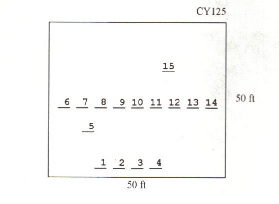
| Size in Feet | 50 |
| Size in Feet | 50 |
| Burials | 15 |
| Inscriptions | 15 |
| Fieldstones | |
| Tombs | |
| Exist? | YES |
| Last seen date? | 2013 |
| Newest | 1891 |
| Oldest | 1793 |
| Vandalism | N |
| Veteran | |
| Pole | G |
| Comment | This cemetery is located 200 feet north of Harkney Hill Road at telephone pole #135, northeast of residence at #2750 Harkney Hill Road and 300 feet southeast of the Duty Cornell Lot, Coventry Historical Cemetery #124. The cemetery is 50 ft x 50 ft, in fair condition, and enclosed with a stone wall with an iron gate. A set of steps in the southeast corner allows entry over the wall. The historic cemetery sign is in good condition. There are 15 burials with 15 inscribed stones.
James N. Arnold visited this lot on 25 Jul. 1905 and noted, “The Wilson lot on farm now owned by Stephen Franklin, formerly the Ichabod Wickes place, lot walled and in fair order” (Vol. 6, Book A, page 1008). The Wilsons owned the large house on the northeast corner of Westwood Road and Harkney Hill Road. They owned 120 acres, including the Quidnick Reservoir.
Found, registered and recorded by Dr. Bill Eddleman and John Sterling for a 1998 book on Coventry cemeteries. |
| Condition | fair |
| Enclosure | stone wall |
| Gate | iron gate |
| Growth | overgrown-trees |
| Terrain | level |
| Cemetery Location |
|
| Cemetery Burial Map |
|
| |
|